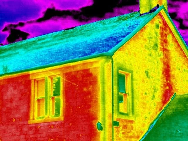
thermal imaging
We provide detailed thermal inspections to identify heat loss, moisture intrusion, and insulation issues in buildings. Our drone-mounted thermal cameras also help detect early signs of structural concerns such as Mica or Pyrite damage—providing clear, actionable insights for homeowners and property professionals.
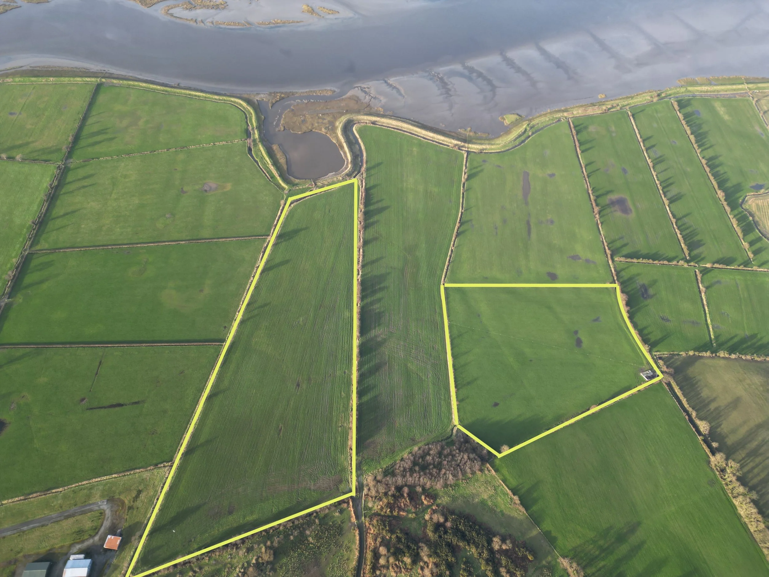
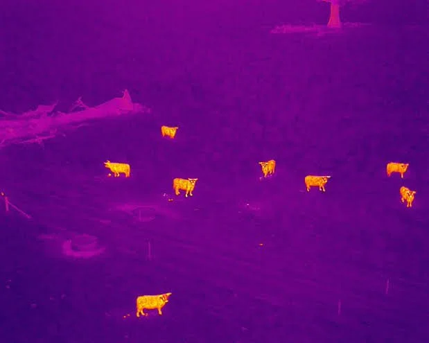
Agricultural imaging
Using high-resolution drone imagery, we generate accurate field maps to help farmers optimize land use, track crop health, and plan operations more efficiently. Our mapping solutions improve visibility over large areas, increasing productivity and decision-making confidence. Thermal imaging helps locate missing or distressed livestock by detecting body heat, even in low visibility conditions like dense grass, woodland, or fog. A fast, efficient solution for farmers looking to protect their stock.
construction monitoring
Our drones capture regular progress updates from above, making it easy to track milestones, inspect builds, and maintain site oversight. We help contractors and clients stay informed and aligned by providing visual documentation and data throughout the construction lifecycle.


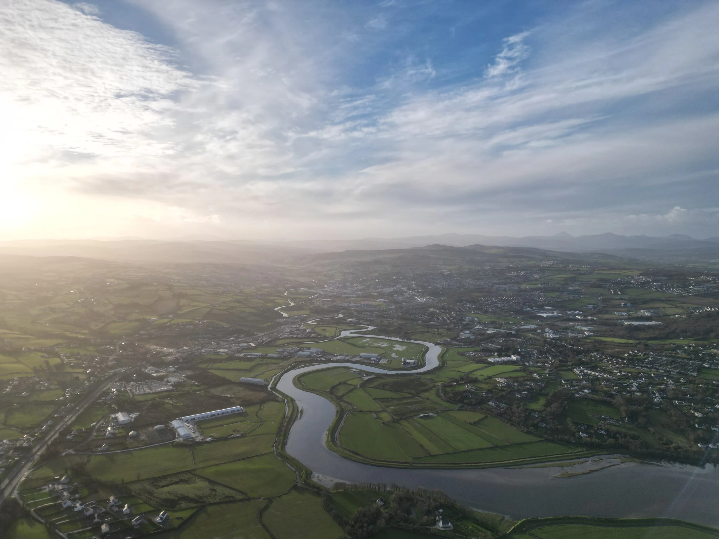
aerial photography
We deliver crisp, high-quality aerial photography for real estate, marketing, property inspection, and more. Whether it’s a farm, home, or development site, our imagery offers a unique perspective that highlights features and communicates scale effectively.